
PLACES TO VISIT IN ÇANAKKALE
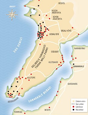
GELİBOLU PENINSULA HISTORICAL NATIONAL PARK
Gallipoli Peninsula Historical National Park is in the Marmara Region, within the borders of Çanakkale province. It was declared a National Park in 1973. Its surface area is 33,490 hectares. There are 1 district (Eceabat) and 8 villages within the boundaries of the Gallipoli Peninsula Historical National Park. The National Park, which includes monuments rising on the cherished memories of more than 250,000 Turkish martyrs and areas where more than 250,000 British, French, Australian and New Zealand soldiers are buried, today tells the whole world the value of peace. There are 56 local monuments and martyrdoms and 35 foreign graves and monuments in the Gallipoli Peninsula Historical National Park.
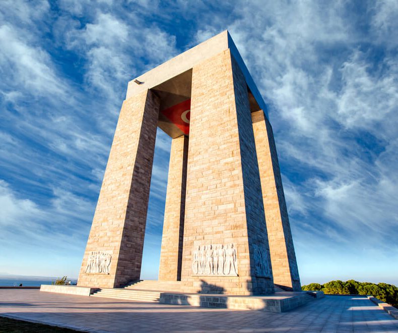
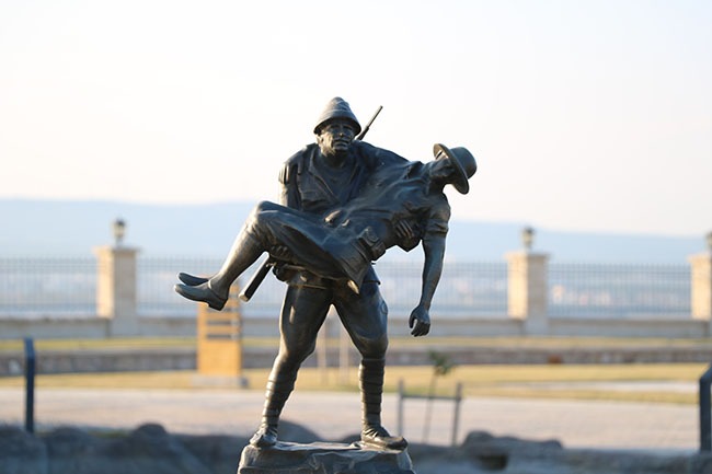
MARTYRS MONUMENT
It is on Hisarlık Hill, rising behind Morto Bay, at the tip of the Gallipoli Peninsula. It was built in memory of those who were martyred in the Çanakkale Wars. Its foundation was laid on 19 April 1954 and it was opened to visitors on 21 August 1960. Reliefs on the feet of the main plinth were completed in 2002, and changes were made to the ceremonial area and symbolic martyrdom in 2004. The monument, which was restored in 2005, took its final shape in 2007 with the construction of a new cemetery on the site. The monument, whose height is 41.70 cm, rises on four legs in an area of 625 square meters. When viewed from a distance, it looks like the letter "M" of Mehmetçik. A mosaic Turkish flag was carved on the ceiling of the monument. The symbolic martyrdom, which was built in 1992 on the left side of the entrance of the monument, was built for our martyrs who gave their lives, their most precious assets, by running to Çanakkale from every corner of our country.
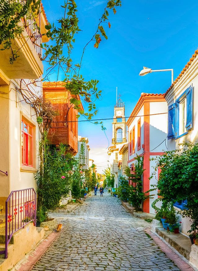
BOZCAADA (TENEDOS)
Bozcaada (Greek: Τένεδος, Tenedos) is the third largest island in Turkey and the second largest island in the Aegean Sea after Gökçeada. It is also a district of Çanakkale province. It is the only town in Turkey without a village except for the provincial centers.
The area is 40 km2 and the distance to the mainland is 6 km. The population of the district according to 2015 data is 2,643 species. In the district, the population falls in the winters and increases in the summers with vacationers. It comes to the fore with viticulture, marine tourism and wind power plants.
Ayazma Beach is definitely the island's No. 1 beach, especially due to its fine-grained, golden-yellow sand, restaurants and cafes around it. Sulubahçe and Habbele Beach and Aquarium, which are located just outside Ayazma beach, can also be preferred. Travel on the island is provided by dolmus. Bikes and engines can be rented as well as dolmus. Every point is accessible with dolmus moving every 15 minutes during the summer months.
Habbele Beach is the most beautiful beach on the island, which is calmer and preferred by local tourists due to the lack of facilities. Although its coast is composed of large and small stones, its sea is composed of fine sand. You can swim with the fish in the sea,which is always sparkling and still.
"Vintage" festivities are held in September. It is also the island's rather splendid Castle to be seen. Bozcaada is one of the few places in Turkey where wind energy is produced. The location of the wind roses displays an extraordinary sight, especially at sunset. Dolmuş departing from the bazaar in the evening, offers the opportunity to tour the island, the exquisite images presented along the way, wind roses climax with the sunset in the location.
Although the island is not very lively, it can be said that there is a nightlife. 1 bar in the city centre offers musical entertainment. However, guests planning to go to the island are advised to come with calmness and rest expectation rather than nightlife and mobility.
The coast of the island is a natural refuge and breeding ground for fish. So trawling around the island can't be done. It is in great demand by amateur fishermen.
The cheapest and most common accommodation on the island is hostels. Historic houses in both Turkish and Greek neighbourhoods are rented by Islander families to tourists. There has been an increase in the number of hotels especially recently. There are also houses rented on the principle of daily price. Since there is no "all-inclusive concept" on the island, it would make sense for trips with more than one person to go to rental homes instead of hotels. Bozcaada hotels have become one of the most important resorts and attractions of the last period thanks to the increasing quality boutique accommodation centers in recent years. In the following years, it is expected that many more boutique hotels will be built on the island as a result of the restoration of the old Greek houses on the island.
GÖKÇEADA (İMROZ)
Gökçeada (Greek: Ίμβρος Imvros) is a district of Çanakkale and the largest island in Turkey. It is located in the north of the Aegean Sea, at the entrance to the Gulf of Saros. 91 km. it has a shoreline of. Annual rainfall varies between 950 – 1050 mm per square meter. Incirburnu, located in the west of the island, is also the westernmost point of Turkey. There were 2 flights to Gökçeada-Istanbul a week in 2011 and 2012, and no commercial passenger flights were made in 2013 and later. Gökçeada is one of 11 inhabited cities(Cittaslow) in Turkey as of 2016.
Central / Çınarlı is the center of the island, public institutions and most of the population are here. There is an airport with scheduled flights. Its Greek name is”Panaghia". Kaleköy, Zeytinliköy, old and New Bademli villages are very close by.
Dereköy is in the inner western part of the island. It is considered to be the largest village in Turkey in the early years of the Republic. It remained the largest village in Gökçeada until the 1970s. It is currently abandoned due to intensive migration. The Greek name of dereköy is”Σχοινούδι (pronounced:Shinudi)". On the feast of the Virgin Mary (15 August), the village is moved by the return of those who emigrated abroad, their children and grandchildren.
Kaleköy is northeast of the island. Kaleköy Pier, I. It was regulated by the French Naval Command during World War II and provided transportation of the entire island until the construction of the new pier at Kuzuliman in the 1970s. However, it is suitable for berthing small tonnage ships and yachts. Until these years, transportation of the island was provided by cruise ships named Ayvalik and Gemlik. His Greek name is”Kastro".Reaching the island twice a week (Wednesday and Saturday) at around 23:00, These ships were unable to dock and had to anchor in the open for about 1.6 km. Transport between the ships and the pier was provided by fishing/sponge boats. The castle, which gave the village its former name, is located on the hill on the right side of the Kaleköy Pier.
Zeytinli is an ancient Greek village in the northern interior of the island, very close to the Central District. There is still a small population of Greek origin. Fener is also the birthplace of the Greek Patriarch Bartholomeos. Its Greek name is”Aya Teodoroi". The Greek Primary School in the village has been opened for education in the past years.
Tepeköy is a Greek village in the north of the island. There is still a small population of Greek origin. Its Greek name is”Agridya". Rum High School and Secondary School located in the village provides education and training.
Uğurlu is located at the westernmost point of Turkey. There is no information about where the name of the village came from and its history. Muğla and Burdur provinces in the 1970s with the placement of families formed villages. It is 25 km from the district center.its economy is based on agriculture, livestock and tourism. Home pensions are the main sources of income and there are many hostels.In the village, there is a primary school but it cannot be used and carry-on education is used. The village has a drinking water network and a sewerage network. The roads of the village interior are covered with stone. There is no PTT branch but there is a PTT agency. There is a health center but it is not used. The road providing access to the village is paved and the village has electricity, landline telephone and internet. Uğurlu village is 100 meters from the sea, but one of the two piers of the island is located in Uğurlu village. As it is located 14 miles from Limni Island, inter-island tourism can determine the new face of the village of Uğurlu for the future.
Bademli is located in the northeast of the island, between the Central District and Kaleköy. Bademli's Greek name is”Gliki".
Yeni Bademli is one of the newly established villages and families from Isparta were settled. It is located in the northeast of the island, in the motel and hostel district. The distance to the sea is 500 meters.
Eşelek is one of the newly established villages and families from Çanakkale have been settled. Eşelek, which is in the southeast of the island, is an agricultural region and fruits and vegetables are produced.
Şahinkaya is the first Turkish village built on the island.[citation needed] in 1973-1974, the settlement came from Şahinkaya (Shur) village in Çaykara District of Trabzon province. Agriculture, Animal Husbandry, pensions in recent years. Directly opposite the village is covered with pine forest. The drinking water of the village comes from the tank fed by 3 different underground sources. The village is close to the southern coast of the island, around 5 km from Laz Bay. Olive oil, honey, Capricorn meat, lamb meat, goat cheese are available in the village.
Şirinköy is one of the newly established villages, where after 80 Bulgarian immigrants were resettled. It is southwest of the island.
Yenimahalle is on the road between the Central District and Kuzulimani. Its Greek name is”Evlampion".

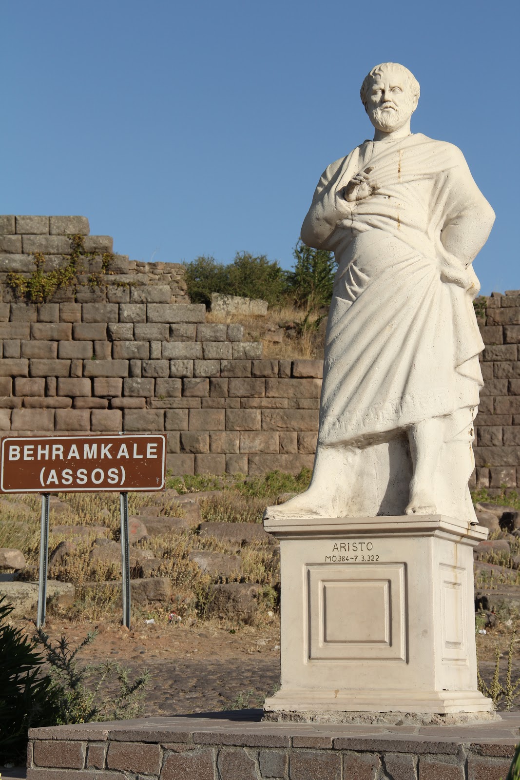
ASSOS ANCIENT CITY
Assos (Greek: Άσσος, nowadays Behramkale) is an ancient city located in Behramkale village, about 17 km south of Ayvacık district of Çanakkale.
It was founded in ancient times on the summit and slopes of a volcanic hill at the southern end of the region called Troas, opposite the island of Lesbos. During the history of Lydia, Persia, Pergamon the region that came under Roman rule was abandoned in the Middle Ages; during the excavations conducted by the American Archaeological Institute in 1880-1883, Francis H. The Young American architect It was found by Bacon.[1]
At the time it was active, Assos had become rich thanks to passing ships, as it had the only major port in its region. The sarcophagi made of andesite stone in Assos became world famous for their rapid decomposition of the bodies laid in them; they were exported to Lebanon, Syria, Greece and Rome in ancient times.[2]
Aristotle, one of the great thinkers of antiquity, lived in this city for three years and founded a school of philosophy. Assos was also visited by Paul and the city is therefore considered holy by Christians.
Founded in 900 BC, the most spectacular place in this city is the Temple of Athena, built at the top of the Doric structure. The city also has a large amphitheatre.
Today, the city of Behramkale, on the slopes and slopes of the mountain where the city is, is still active.
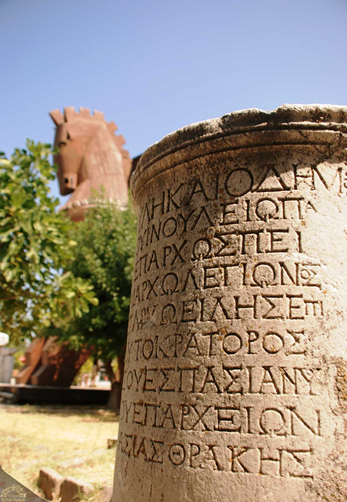
TROIA OR TROYA
Troia or Troya Hittite: Wilusa or Truwisa, The Historical City at the foot of Mount Kaz (the ancient Mount Ida), located within the boundaries of the province of Çanakkale.the city of Troy . Asia Minor in late Classical Antiquity, now called Anatolia in modern Turkey, is a city located just south of the southwestern mouth of the Dardanelles Strait and northwest of Mount Ida. The present location is known as the Fortress. It is the ancient city where the Battle of Troy took place, mentioned in The Iliad, one of the two verse epics believed to have been written by Homer. Discovered by German amateur archaeologist Heinrich Schliemann in the 1870s near the village of Tevfikiye, most of the artifacts unearthed in the ancient city are in today's Turkey, Germany and Russia. The ancient city has been on the World Heritage list since 1998 and has been a National Park since 1996.
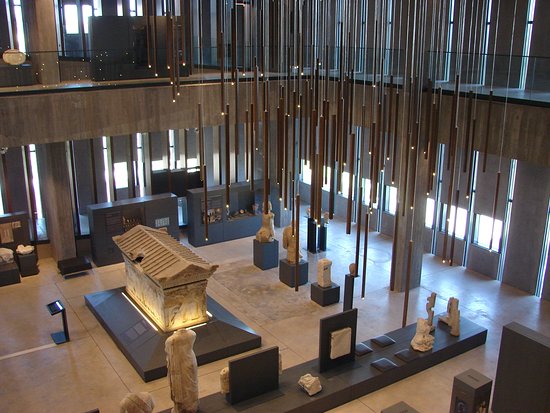
TROYA MUSEUM
KAZDAĞI MİLLİ PARKI (İDA DAĞI)
Kaz Dağı / Ida Dağı is a mountain located in the north of Edremit Bay between Çanakkale and Balıkesir provinces.The mountain, named in two forms as Goose Mountain or goose Mountains, lies largely on the Biga Peninsula. The Kaz Mountains consist of Dede Mountain in the West, mainly Kaz Mountain and Three Hills (Babadağ in the north, Karataş Hill in the middle, Sarıkız Hill in the South) Eybek Mountain in the east, Horgen Mountain and Kocakatran Mountain in the North East.
The highest peak of the main Kaz Mountain, which has three Hills, is Karataş Hill, which is 1774 meters and falls in the north-north-west direction of the town of Gure in the Edremit district of Balıkesir. The ayazma promenade in the Bayramic District of Çanakkale falls to the north west of the summit of Mount Kaz and can be reached by following the Evciler Resort road of about 17 km from Bayramic to reach the Promenade Place and crossing the 6 km road after Evciler.
The most important Center in the region is Küçükkuyu in the Ayvacık district of Çanakkale and Altınoluk districts in the Edremit district of Balıkesir. In addition, Altinoluk has the second cleanest air after the Alpine mountains, with the second cleanest oxygen ratio in the world.
Üç tepesi olan esas Kaz Dağı’nın en yüksek tepesi 1774 metre olan Karataş Tepesi’dir ve Balıkesir’in Edremit ilçesi Güre beldesinin kuzey batı istikametine düşmektedir. Çanakkale’nin Bayramiç ilçesi Ayazma mesire yeri ise Kaz Dağı zirvesinin kuzey batısına düşmektedir ve mesire yerine ulaşmak için Bayramiç’ten yaklaşık 17 km’lik Evciler Beldesi yolunu takip edip, Evciler’den sonra 6 km’lik yol aşılarak ulaşılabilir.
Bölgedeki en önemli merkez Çanakkale’nin Ayvacık ilçesine bağlı Küçükkuyu ve Balıkesir’in Edremit ilçesine bağlı Altınoluk beldeleridir. Ayrıca Altınoluk, Alp Dağları’ndan sonra dünyanın en temiz ikinci yüksek oksijen oranıyla en temiz ikinci havasına sahiptir.
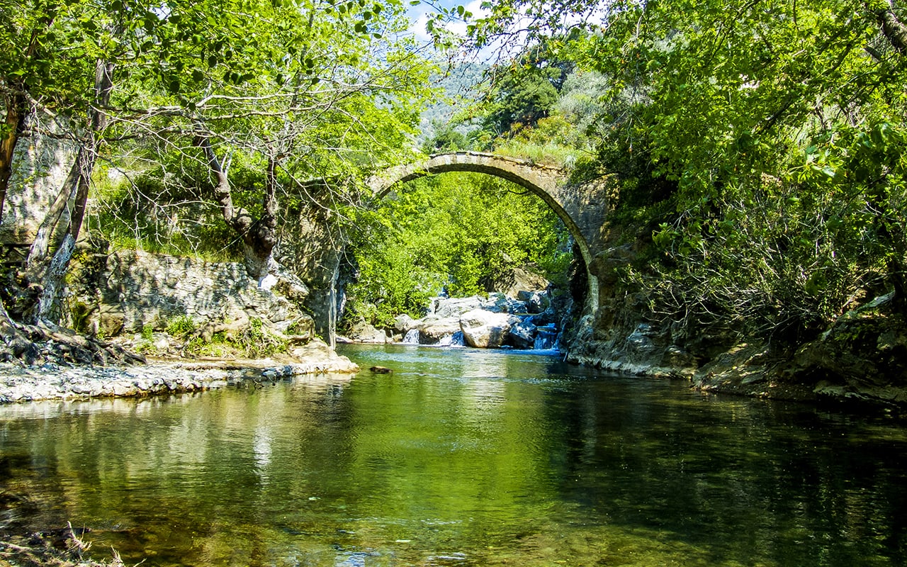
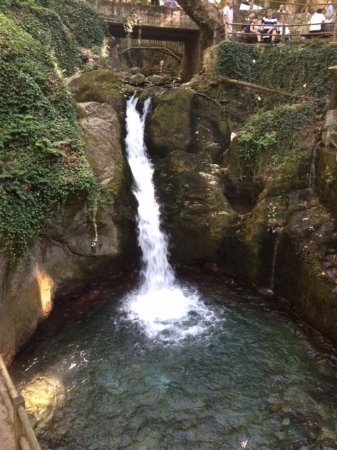
BAYRAMİÇ AYAZMA
Ayazma Recreation Place in Kaz Mountains, known as Çanakkale's oxygen reservoir, is located near the village of sahibinden.com, of Bayramiç district. After you reach the village of sahibinden.com from Bayramiç district, after 5 kilometers further, you come to this magnificent promenade. Despite the hot weather in the city and district centre, here You have the opportunity to cool off when you reach it. Ayazma Promenade, one of the most beautiful recreation facilities of Kaz Mountains with its unique tall trees and ice-cold waters, is also one of the places for daily vacation. Besides picnickers, small trekking groups that have come to Ayazma in recent years have also camped in the area here. Feasting at the tables around the spring water of Ayazma, which is covered with pine trees, adds a different color to this place. After spending a nice day in Ayazma, you also have the chance to choose, cook and eat live fish at the Trout Facilities near the village of sahibinden.
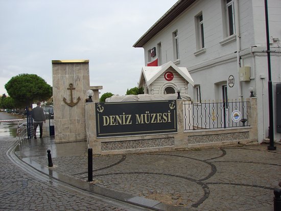
ÇANAKKALE MARITIME MUSEUM
Çanakkale Naval Museum, located in Çanakkale Çimenlik Castle, hosts the sacred heritage of the Çanakkale struggle. Since it is affiliated to the Naval Forces Command, it is considered a military museum. After visiting the places where the Dardanelles war took place and our martyrs, it would be beneficial to head towards Çimenlik Castle. After the martyrdoms, this is the most important place to visit in Çanakkale. There is a large park in the museum, which covers a large area, where you can take a breather. There are Çimenlik Castle, a beautiful model of the Nusrat minelayer, dozens of pictures and photographs describing the Dardanelles war, a library, weapons used in the war, bullets, military clothes and many heritages describing that day. You can buy Çanakkale souvenirs in the souvenir building located in the museum. There is also a Çanakkale War specialized library. Here you can read and buy works about Çanakkale that you have not read before.
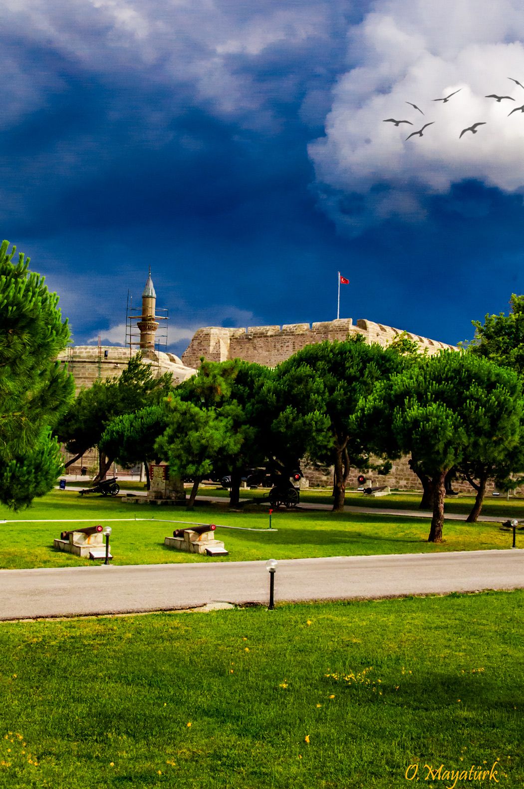
ÇİMENLİK CASTLE
This castle is the fortune of the Çanakkale city. The old name of this Castle was “Kala-i Sultaniye” which build by Fatih Sultan Mehmet at 1462. This is the one of Castle that builds by Fatih Sultan Mehmet the both side of grand. You can enjoy the grand landscape from here too and visit this Castle which was arranged like a Sea Museum now.
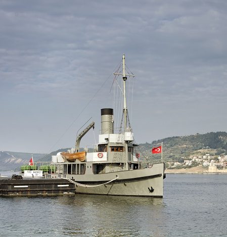
NUSRAT MINE SHIP
The Nusrat Mine Ship (model), which played an important role in the Battle of Çanakkale, is open to visitors in Çimenlik Castle. With a digital presentation and boards, the heroes of the Dardanelles struggle are told to the visitors. Some technical information is also given about the Nusret Minelayer. After the Nusret Mine Ship, you can go to the Dardanelles Wars library. Many foreign and domestic resources are offered to visitors in this library. When you enter the museum, there is a souvenir building on the left. last visit here. First of all, experience that time by visiting our heritage about Çanakkale. Then, buy a gift that most reminds you of the feelings you experienced in the gift shop and put it in a place where you can always see it. In this way, you become a person who manifests the purpose of this museum, which was established to keep the spirit of Çanakkale alive. There are various publications, items reminiscent of Çanakkale, and paintings with sea motifs in the souvenir building. Mines greet you on the ground floor of the Picture and Photo Gallery building. On the next floor, there are models and paintings that portray the Battle of Gallipoli. The architectural structure of the building will attract your attention. Because it bears the traces of Ottoman architecture. This very nostalgic building was previously used by the military as an ammunition depot. When the decision to establish a museum was taken in 1982, the painting exhibition was put into a suitable structure.
ANATOLIAN HAMIDIY BASE
It is located in Çanakkale Central Barbaros District and was built by Sultan II in 1892 to ensure the security of the Bosphorus. The Anatolian Hamidiye Bastion, built by Abdülhamit, has 10 registered bonet (arsenal) structures and 9 cannon shooting areas located in a semi-circular form among them. The "Anatolian Hamidiye Bastion and Gallipoli Minia Exhibition, Arrangement and Landscaping" project, which the Ministry of Culture and Tourism allocates 40 million appropriations and started to be restored in February 2014, was completed in 2017 and opened its doors to visitors in November 2018.
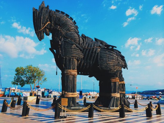
CANAKKALE TROY STATUE
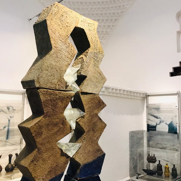
ÇANAKKALE CERAMIC MUSEUM
The historical building, which was built as the Private Bath in 1905 in the city center of Çanakkale, was turned into a "Ceramics Museum" in 2013 after the restoration works of Çanakkale Municipality. The Ceramic Museum, located in Cevatpaşa Mahallesi, Kaya Sokak, exhibits the important works of the city in the field of ceramics. . The arrangement of the sections serving as coldness, warmth and warmth in the bathhouse, which is used as the Ceramic Museum, as the entrance to the Ceramic Museum, the resting and information area and the exhibition areas adds a different color to the facility. They can get information about the history of the building and the content of the exhibitions. It is known that the toilet stones and basins in the Old Bath are original, and there is a garden at the back of the Ceramic Museum. We recommend that those who come to visit Çanakkale do not leave without seeing the Ceramic Museum…